-
World map outline with highlighted continents and islands on a transparent background
Do ulubionych favorite_border
Usuń z ulubionych favorite
-
Planisphère Mappemonde Vintage - Textes en français. Vecteur CMJN
Do ulubionych favorite_border
Usuń z ulubionych favorite
-
World Map vector. Gray similar world map blank vector on transparent background. Gray similar world map with borders of all countries and States of USA map. High quality world map. EPS10.
Do ulubionych favorite_border
Usuń z ulubionych favorite
-
World Map Vintage Vector. Detailed illustration of worldmap
Do ulubionych favorite_border
Usuń z ulubionych favorite
-
Blue vintage world map illustration based on image furnished by NASA
Do ulubionych favorite_border
Usuń z ulubionych favorite
-
Do ulubionych favorite_border
Usuń z ulubionych favorite
-
weltkarte mit grenzen, kompass
Do ulubionych favorite_border
Usuń z ulubionych favorite
-
Einfach Weltkarte aus Punkten in hellgrau
Do ulubionych favorite_border
Usuń z ulubionych favorite
-
Abstract world map created with blue circles on transparent background global concept illustration
Do ulubionych favorite_border
Usuń z ulubionych favorite
-
Highly detailed political world map
Do ulubionych favorite_border
Usuń z ulubionych favorite
-
Children's map of the world with sights detailed grey
Do ulubionych favorite_border
Usuń z ulubionych favorite
-
halftone world map vector illustration
Do ulubionych favorite_border
Usuń z ulubionych favorite
-
Do ulubionych favorite_border
Usuń z ulubionych favorite
-
Do ulubionych favorite_border
Usuń z ulubionych favorite
-
world map logo design,globe,world,earth,icon,map,global,world,vector,logo,design,earth,graphic,globe,sign,planet,symbol,element,travel,modern,abstract,web,illustration,internet,isolated,circle,network
Do ulubionych favorite_border
Usuń z ulubionych favorite
-
World map illustration global continents
Do ulubionych favorite_border
Usuń z ulubionych favorite
-
Do ulubionych favorite_border
Usuń z ulubionych favorite
-
Detailed vector illustration of a world map showing continents, countries, and natural features oceans and seas .
Do ulubionych favorite_border
Usuń z ulubionych favorite
-
Do ulubionych favorite_border
Usuń z ulubionych favorite
-
Highly Detailed Political World Map Vintage Colors
Do ulubionych favorite_border
Usuń z ulubionych favorite
-
Do ulubionych favorite_border
Usuń z ulubionych favorite
-
Abstract digital world map illustration created with square pixel grid patterns representing global internet communication, international data networks, and technology connection concepts.
Do ulubionych favorite_border
Usuń z ulubionych favorite
-
World map vector grey isolated on white background. Flat Earth, Globe world map icon. Travel worldwide eps 10
Do ulubionych favorite_border
Usuń z ulubionych favorite
-
World Map Vintage Cartoon Detailed - vector
Do ulubionych favorite_border
Usuń z ulubionych favorite
-
Topography and geography map. modern wallpaper texture and 3d realistic design. 3D waves. Retro topography map. Business concept. Vintage outdoors style. World Map Vintage Old-Style. Transparent PNG
Do ulubionych favorite_border
Usuń z ulubionych favorite
-
airplane on world map background. concept of plane travel. Empty space for text - booking a flight ticket
Do ulubionych favorite_border
Usuń z ulubionych favorite
-
Do ulubionych favorite_border
Usuń z ulubionych favorite
-
Do ulubionych favorite_border
Usuń z ulubionych favorite
-
Vintage world map, educational geography poster, antique-style wall art, travel-themed decor, kids room, global nations, illustrated, detailed, aesthetic
Do ulubionych favorite_border
Usuń z ulubionych favorite
-
Creative vertical line shape dotted map showing world continents like Africa, Asia, and Europe. A clean infographic style earth layout. Designed for global data visualization.
Do ulubionych favorite_border
Usuń z ulubionych favorite
-
Do ulubionych favorite_border
Usuń z ulubionych favorite
-
Earth globe set. World map in globe shape. Earth globes collection on isolated background. Flat style - stock vector.
Do ulubionych favorite_border
Usuń z ulubionych favorite
-
Wireless communication smart city and network technology of the world.
Do ulubionych favorite_border
Usuń z ulubionych favorite
-
Globe data world map. Globe Ai halftone background. Round particles dots technology banner. Artificial Intelligence futuristic sphere network connect vector design.
Do ulubionych favorite_border
Usuń z ulubionych favorite
-
vector political dark grey world map
Do ulubionych favorite_border
Usuń z ulubionych favorite
-
Do ulubionych favorite_border
Usuń z ulubionych favorite
-
World map point and line composition concept of global business. Global network connection. Vector Illustration Free Vector
Do ulubionych favorite_border
Usuń z ulubionych favorite
-
Envíos a todo el mundo desde México. Imágen del mundo con conexiones iluminadas.
Do ulubionych favorite_border
Usuń z ulubionych favorite
-
Global Financial Data Connections Overlayed on World Map.
Do ulubionych favorite_border
Usuń z ulubionych favorite
-
3D globe vector illustration image with world map
Do ulubionych favorite_border
Usuń z ulubionych favorite
-
Spherical Gray World Map. Global geography concept. Vector illustration.
Do ulubionych favorite_border
Usuń z ulubionych favorite
-
World Map Political and Flags - Vector Detailed Illustration
Do ulubionych favorite_border
Usuń z ulubionych favorite
-
World Map Political - vector illustration. Highly detailed map of the world: countries, cities, water objects
Do ulubionych favorite_border
Usuń z ulubionych favorite
-
World Map - Highly Detailed Topographic Relief Vector Map of the World. Ideally for the Print Posters
Do ulubionych favorite_border
Usuń z ulubionych favorite
-
Grayscale World Map - borders, countries and cities - illustration Highly detailed gray vector illustration of world map.
Do ulubionych favorite_border
Usuń z ulubionych favorite
-
World Map - Pacific View - Asia China Center - Political Topographic - Detailed Illustration
Do ulubionych favorite_border
Usuń z ulubionych favorite
-
World Map Vintage Old-Style - vector - blue and beige
Do ulubionych favorite_border
Usuń z ulubionych favorite
-
World Map Vector. Detailed illustration of worldmap
Do ulubionych favorite_border
Usuń z ulubionych favorite
-
World Map Vintage Political - Detailed Illustration - Layers
Do ulubionych favorite_border
Usuń z ulubionych favorite
-
Political Vintage Golden World Map Vector
Do ulubionych favorite_border
Usuń z ulubionych favorite
-
Political Physical Topographic Colored World Map Pacific Centered
Do ulubionych favorite_border
Usuń z ulubionych favorite
-
World Map - Pacific China Asia Centered View - Blue Color Political - Vector
Do ulubionych favorite_border
Usuń z ulubionych favorite
-
World Map Vintage Black Golden Detailed - Vector
Do ulubionych favorite_border
Usuń z ulubionych favorite
-
Vertical dotted world map in rectangular layout with geometric lines and halftone details. A digital representation of global continents. Ideal for business, atlas, or technology designs.
Do ulubionych favorite_border
Usuń z ulubionych favorite
-
Do ulubionych favorite_border
Usuń z ulubionych favorite
-
Detailed world map illustrating tectonic plates and their boundaries, with labeled regions and directional arrows indicating movement, designed for educational use in geology and earth science studies
Do ulubionych favorite_border
Usuń z ulubionych favorite
-
Red Curved World Map Silhouette - Global Connection and Business Concept Vector
Do ulubionych favorite_border
Usuń z ulubionych favorite
-
Professional World Map Vector with Graticule Grid, Navy Blue Political Map on Transparent Background
Do ulubionych favorite_border
Usuń z ulubionych favorite
-
Black halftone world map on with grid pattern texture
Do ulubionych favorite_border
Usuń z ulubionych favorite
-
Global Digital Network and Data Connection with Earth Technology Background and Communication Icons
Do ulubionych favorite_border
Usuń z ulubionych favorite
-
Airplane flies glowing 3D world map with interconnected travel routes. Represents global air travel, aviation logistics, and international connectivity in a digital tech style.
Do ulubionych favorite_border
Usuń z ulubionych favorite
-
world map halftone dotted globe background black dot earth vector illustration
Do ulubionych favorite_border
Usuń z ulubionych favorite
-
World Population Day Graphic: A vibrant and colorful graphic illustrating the interconnectedness of global populations, with icons representing people, Earth, and communication networks.
Do ulubionych favorite_border
Usuń z ulubionych favorite
-
World map made of dots global connection concept
Do ulubionych favorite_border
Usuń z ulubionych favorite
-
Vintage nautical map with sailing ship and compass rose, antique exploration theme, detailed historical illustration
Do ulubionych favorite_border
Usuń z ulubionych favorite
-
Detailed World Map Vector with Country Borders Global Geography Outline
Do ulubionych favorite_border
Usuń z ulubionych favorite
-
Dotted world map silhouette background with brown halftone geometric pattern for global network vector illustration.
Do ulubionych favorite_border
Usuń z ulubionych favorite
-
Curved World Map Silhouette, Half Globe Blue Planet Earth, Worldwide Geography Business Travel Map, Africa Asia America Europe Australia Vector Illustration.
Do ulubionych favorite_border
Usuń z ulubionych favorite
-
Map of Canada showing the region with relief representation, rivers, lakes, administrative boundaries and undersea relief. No labels at all.
Do ulubionych favorite_border
Usuń z ulubionych favorite
-
World Map Silhouette with United States of America (USA) Highlighted in Red
Do ulubionych favorite_border
Usuń z ulubionych favorite
-
Do ulubionych favorite_border
Usuń z ulubionych favorite
-
World map with location pins drawn in single line art style Vector, illustration
Do ulubionych favorite_border
Usuń z ulubionych favorite
-
Media curator using laptop with Digital Asset Management on a virtual screen with storage graphs. A world map tracks file access. Organizing and securing high-value digital creative assets.
Do ulubionych favorite_border
Usuń z ulubionych favorite
-
Dotted World Map Vector Collection Five Stylized Global Maps in Gray and Black for Data Visualization, Tech Connectivity, Population Density Infographics, and Corporate Website Header Backgrounds.
Do ulubionych favorite_border
Usuń z ulubionych favorite
-
World map silhouette vector illustration featuring simplified black continents without borders, ideal for educational, design, and global motifs
Do ulubionych favorite_border
Usuń z ulubionych favorite
-
Colorful kids cartoon world map vector, simplified global geography design with animals and landmarks.
Do ulubionych favorite_border
Usuń z ulubionych favorite
-
Black and white world map outline illustration showing global continents geography boundaries for education navigation infographic design and international mapping concepts
Do ulubionych favorite_border
Usuń z ulubionych favorite
-
Premium Vector World Map Bundle: 3 Projections, 3D Globe and Flat Geographic Infographic in Business Blue
Do ulubionych favorite_border
Usuń z ulubionych favorite
-
Gray World Map with Red Location Pins Global Travel Vector
Do ulubionych favorite_border
Usuń z ulubionych favorite
-
four globes in flat icon style earth planet world map geography vector illustration black white blue green continents oceans simple design
Do ulubionych favorite_border
Usuń z ulubionych favorite
-
Do ulubionych favorite_border
Usuń z ulubionych favorite
-
International Literacy Day banner template with group of people standing on open book vector design
Do ulubionych favorite_border
Usuń z ulubionych favorite
-
Dot matrix world map illustration depicting global geography and continents
Do ulubionych favorite_border
Usuń z ulubionych favorite
-
Global network or business with pin locations on a world map, representing worldwide presence, international connections, and global reach.
Do ulubionych favorite_border
Usuń z ulubionych favorite
-
Black world map made of small square pixels and dots representing global geography and digital connectivity concepts
Do ulubionych favorite_border
Usuń z ulubionych favorite
-
Black and white illustration of a world map in a pixelated style
Do ulubionych favorite_border
Usuń z ulubionych favorite
-
Green Political World Map with All Country Borders and Continents Isolated on White Background
Do ulubionych favorite_border
Usuń z ulubionych favorite
-
World map outline showing continents and oceans
Do ulubionych favorite_border
Usuń z ulubionych favorite
-
Prime Meridian. World map. Cylindrical equal-area projection centered to Prime Meridian. Pale Mint Dark Pink palette. Vintage texture. Charming vector illustration.
Do ulubionych favorite_border
Usuń z ulubionych favorite
-
Colored World Political Map Flat Vector Illustration
Do ulubionych favorite_border
Usuń z ulubionych favorite
-
Printable Black and White World Map with Country Borders – High‑Resolution Vector
Do ulubionych favorite_border
Usuń z ulubionych favorite
-
Simple line drawing of world map with highlighted coastal areas
Do ulubionych favorite_border
Usuń z ulubionych favorite
-
Minimalist airline boarding pass blank template with barcode. Airplane ticket isolated on white background. Blue travel boarding pass design with world map background. Colored flat vector illustration
Do ulubionych favorite_border
Usuń z ulubionych favorite
-
two colorful globe world map icons with blue oceans and green continents, earth planet vector illustration, geography global design element set
Do ulubionych favorite_border
Usuń z ulubionych favorite
-
Customizable World Map Standard (Plate Carr?e) - Equirectangular
Do ulubionych favorite_border
Usuń z ulubionych favorite
-
Stylized black halftone world map illustration on a clean white background, perfect for global business and technology designs.
Do ulubionych favorite_border
Usuń z ulubionych favorite
-
A detailed world map illustration showing continents, oceans, and geographical features in a vintage gold and dark blue color scheme.
Do ulubionych favorite_border
Usuń z ulubionych favorite
-
Pixel art fantasy world map, retro 8-bit video game landscape with forest and lakes, top-down RPG game level design vector illustration
Do ulubionych favorite_border
Usuń z ulubionych favorite
-
India Highlighted on World Map Vector Design
Do ulubionych favorite_border
Usuń z ulubionych favorite
-
Global Logistics Network with World Map and Various Transport Modes.
Do ulubionych favorite_border
Usuń z ulubionych favorite
 World map outline with highlighted continents and islands on a transparent backgroundfavorite_border favorite
 Planisphère Mappemonde Vintage - Textes en français. Vecteur CMJNfavorite_border favorite
 World Map vector. Gray similar world map blank vector on transparent background. Gray similar world map with borders of all countries and States of USA map. High quality world map. EPS10.favorite_border favorite
 World Map Vintage Vector. Detailed illustration of worldmapfavorite_border favorite
 Blue vintage world map illustration based on image furnished by NASAfavorite_border favorite
 weltkartefavorite_border favorite
 weltkarte mit grenzen, kompassfavorite_border favorite
 Einfach Weltkarte aus Punkten in hellgraufavorite_border favorite
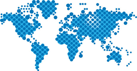 Abstract world map created with blue circles on transparent background global concept illustrationfavorite_border favorite
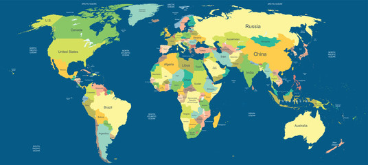 Highly detailed political world mapfavorite_border favorite
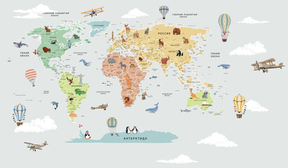 Children's map of the world with sights detailed greyfavorite_border favorite
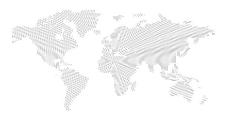 halftone world map vector illustrationfavorite_border favorite
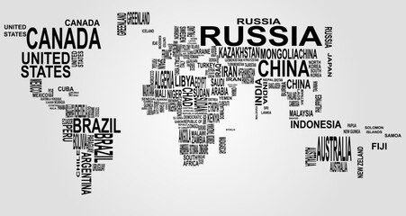 text mapfavorite_border favorite
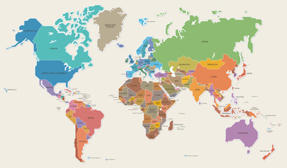 世界地図 色分け 国名 ベクター イラストfavorite_border favorite
 world map logo design,globe,world,earth,icon,map,global,world,vector,logo,design,earth,graphic,globe,sign,planet,symbol,element,travel,modern,abstract,web,illustration,internet,isolated,circle,networkfavorite_border favorite
 World map illustration global continentsfavorite_border favorite
 Orange World mapfavorite_border favorite
 Detailed vector illustration of a world map showing continents, countries, and natural features oceans and seas .favorite_border favorite
 Weltkartefavorite_border favorite
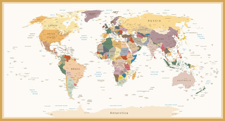 Highly Detailed Political World Map Vintage Colorsfavorite_border favorite
 パースのある世界地図 ドット ベクター素材favorite_border favorite
 Abstract digital world map illustration created with square pixel grid patterns representing global internet communication, international data networks, and technology connection concepts.favorite_border favorite
 World map vector grey isolated on white background. Flat Earth, Globe world map icon. Travel worldwide eps 10favorite_border favorite
 World Map Vintage Cartoon Detailed - vectorfavorite_border favorite
 Topography and geography map. modern wallpaper texture and 3d realistic design. 3D waves. Retro topography map. Business concept. Vintage outdoors style. World Map Vintage Old-Style. Transparent PNGfavorite_border favorite
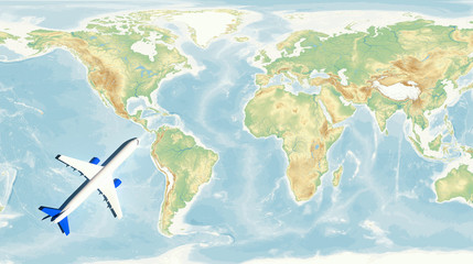 airplane on world map background. concept of plane travel. Empty space for text - booking a flight ticketfavorite_border favorite
 世界地図(簡略化されたアウトラインの世界地図)favorite_border favorite
 ラフな線で描かれた世界地図のイラスト素材favorite_border favorite
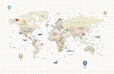 Vintage world map, educational geography poster, antique-style wall art, travel-themed decor, kids room, global nations, illustrated, detailed, aestheticfavorite_border favorite
 Creative vertical line shape dotted map showing world continents like Africa, Asia, and Europe. A clean infographic style earth layout. Designed for global data visualization.favorite_border favorite
 Weltkarte (Vektorgrafik)favorite_border favorite
 Earth globe set. World map in globe shape. Earth globes collection on isolated background. Flat style - stock vector.favorite_border favorite
 Wireless communication smart city and network technology of the world.favorite_border favorite
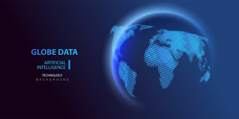 Globe data world map. Globe Ai halftone background. Round particles dots technology banner. Artificial Intelligence futuristic sphere network connect vector design.favorite_border favorite
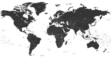 vector political dark grey world mapfavorite_border favorite
 World mapfavorite_border favorite
 World map point and line composition concept of global business. Global network connection. Vector Illustration Free Vectorfavorite_border favorite
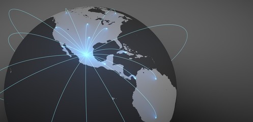 Envíos a todo el mundo desde México. Imágen del mundo con conexiones iluminadas.favorite_border favorite
 Global Financial Data Connections Overlayed on World Map.favorite_border favorite
 3D globe vector illustration image with world mapfavorite_border favorite
 Spherical Gray World Map. Global geography concept. Vector illustration.favorite_border favorite
 World Map Political and Flags - Vector Detailed Illustrationfavorite_border favorite
 World Map Political - vector illustration. Highly detailed map of the world: countries, cities, water objectsfavorite_border favorite
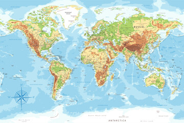 World Map - Highly Detailed Topographic Relief Vector Map of the World. Ideally for the Print Postersfavorite_border favorite
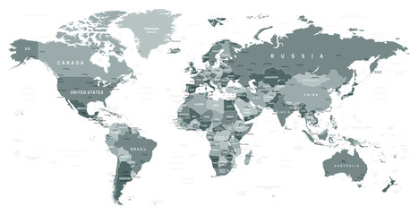 Grayscale World Map - borders, countries and cities - illustration Highly detailed gray vector illustration of world map.favorite_border favorite
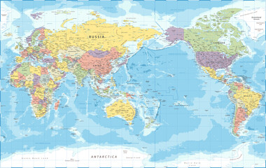 World Map - Pacific View - Asia China Center - Political Topographic - Detailed Illustrationfavorite_border favorite
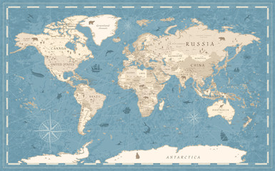 World Map Vintage Old-Style - vector - blue and beigefavorite_border favorite
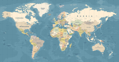 World Map Vector. Detailed illustration of worldmapfavorite_border favorite
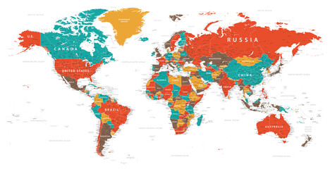 World Map Vintage Political - Detailed Illustration - Layersfavorite_border favorite
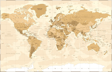 Political Vintage Golden World Map Vectorfavorite_border favorite
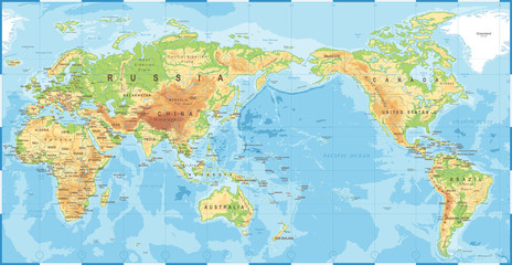 Political Physical Topographic Colored World Map Pacific Centeredfavorite_border favorite
 World Map - Pacific China Asia Centered View - Blue Color Political - Vectorfavorite_border favorite
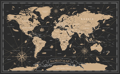 World Map Vintage Black Golden Detailed - Vectorfavorite_border favorite
 Vertical dotted world map in rectangular layout with geometric lines and halftone details. A digital representation of global continents. Ideal for business, atlas, or technology designs.favorite_border favorite
 AnimalWorldMap_01favorite_border favorite
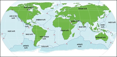 Detailed world map illustrating tectonic plates and their boundaries, with labeled regions and directional arrows indicating movement, designed for educational use in geology and earth science studiesfavorite_border favorite
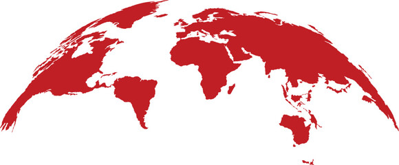 Red Curved World Map Silhouette - Global Connection and Business Concept Vectorfavorite_border favorite
 Professional World Map Vector with Graticule Grid, Navy Blue Political Map on Transparent Backgroundfavorite_border favorite
 Black halftone world map on with grid pattern texturefavorite_border favorite
 Global Digital Network and Data Connection with Earth Technology Background and Communication Iconsfavorite_border favorite
 Airplane flies glowing 3D world map with interconnected travel routes. Represents global air travel, aviation logistics, and international connectivity in a digital tech style.favorite_border favorite
 world map halftone dotted globe background black dot earth vector illustrationfavorite_border favorite
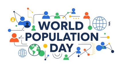 World Population Day Graphic: A vibrant and colorful graphic illustrating the interconnectedness of global populations, with icons representing people, Earth, and communication networks.favorite_border favorite
 World map made of dots global connection conceptfavorite_border favorite
 Vintage nautical map with sailing ship and compass rose, antique exploration theme, detailed historical illustrationfavorite_border favorite
 Detailed World Map Vector with Country Borders Global Geography Outlinefavorite_border favorite
 Dotted world map silhouette background with brown halftone geometric pattern for global network vector illustration.favorite_border favorite
 Curved World Map Silhouette, Half Globe Blue Planet Earth, Worldwide Geography Business Travel Map, Africa Asia America Europe Australia Vector Illustration.favorite_border favorite
 Map of Canada showing the region with relief representation, rivers, lakes, administrative boundaries and undersea relief. No labels at all.favorite_border favorite
 World Map Silhouette with United States of America (USA) Highlighted in Redfavorite_border favorite
 world map vectorfavorite_border favorite
 World map with location pins drawn in single line art style Vector, illustrationfavorite_border favorite
 Media curator using laptop with Digital Asset Management on a virtual screen with storage graphs. A world map tracks file access. Organizing and securing high-value digital creative assets.favorite_border favorite
 Dotted World Map Vector Collection Five Stylized Global Maps in Gray and Black for Data Visualization, Tech Connectivity, Population Density Infographics, and Corporate Website Header Backgrounds.favorite_border favorite
 World map silhouette vector illustration featuring simplified black continents without borders, ideal for educational, design, and global motifsfavorite_border favorite
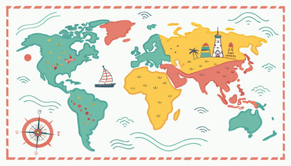 Colorful kids cartoon world map vector, simplified global geography design with animals and landmarks.favorite_border favorite
 Black and white world map outline illustration showing global continents geography boundaries for education navigation infographic design and international mapping conceptsfavorite_border favorite
 Premium Vector World Map Bundle: 3 Projections, 3D Globe and Flat Geographic Infographic in Business Bluefavorite_border favorite
 Gray World Map with Red Location Pins Global Travel Vectorfavorite_border favorite
 four globes in flat icon style earth planet world map geography vector illustration black white blue green continents oceans simple designfavorite_border favorite
 World map of line art.favorite_border favorite
 International Literacy Day banner template with group of people standing on open book vector designfavorite_border favorite
 Dot matrix world map illustration depicting global geography and continentsfavorite_border favorite
 Global network or business with pin locations on a world map, representing worldwide presence, international connections, and global reach.favorite_border favorite
 Black world map made of small square pixels and dots representing global geography and digital connectivity conceptsfavorite_border favorite
 Black and white illustration of a world map in a pixelated stylefavorite_border favorite
 Green Political World Map with All Country Borders and Continents Isolated on White Backgroundfavorite_border favorite
 World map outline showing continents and oceansfavorite_border favorite
 Prime Meridian. World map. Cylindrical equal-area projection centered to Prime Meridian. Pale Mint Dark Pink palette. Vintage texture. Charming vector illustration.favorite_border favorite
 Colored World Political Map Flat Vector Illustrationfavorite_border favorite
 Printable Black and White World Map with Country Borders – High‑Resolution Vectorfavorite_border favorite
 Simple line drawing of world map with highlighted coastal areasfavorite_border favorite
 Minimalist airline boarding pass blank template with barcode. Airplane ticket isolated on white background. Blue travel boarding pass design with world map background. Colored flat vector illustrationfavorite_border favorite
 two colorful globe world map icons with blue oceans and green continents, earth planet vector illustration, geography global design element setfavorite_border favorite
 Customizable World Map Standard (Plate Carr?e) - Equirectangularfavorite_border favorite
 Stylized black halftone world map illustration on a clean white background, perfect for global business and technology designs.favorite_border favorite
 A detailed world map illustration showing continents, oceans, and geographical features in a vintage gold and dark blue color scheme.favorite_border favorite
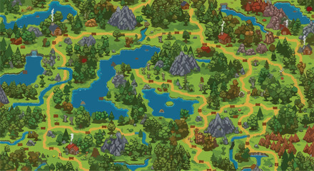 Pixel art fantasy world map, retro 8-bit video game landscape with forest and lakes, top-down RPG game level design vector illustrationfavorite_border favorite
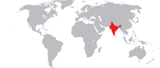 India Highlighted on World Map Vector Designfavorite_border favorite
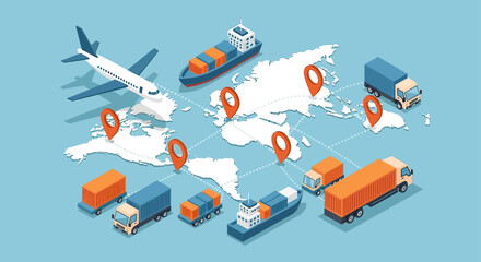 Global Logistics Network with World Map and Various Transport Modes.favorite_border favorite